- 机器人、自动化、工业信息技术 >
- 工业软件 >
- CAD软件 >
- Leica/徕卡
Leica/徕卡CAD软件
{{product.productLabel}} {{product.model}}
{{#if product.featureValues}}{{product.productPrice.formattedPrice}} {{#if product.productPrice.priceType === "PRICE_RANGE" }} - {{product.productPrice.formattedPriceMax}} {{/if}}
{{#each product.specData:i}}
{{name}}: {{value}}
{{#i!=(product.specData.length-1)}}
{{/end}}
{{/each}}
{{{product.idpText}}}
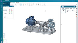
利用基于 Web 的工程平台加速您的数字化转型之旅,为您的团队简化制造、运营、协作、设计和仿真。 为何选择 Zel X? 使用经济实惠的软件提高报价成功率和客户满意度,消除制造错误,缩短工程时间并降低 IT 成本。在基于浏览器的应用程序中访问 CAD、CAM、CAE、MRP、RFQ 工具。 Zel X 试用版 即时访问 Zel X 免费试用版,亲自尝试一下吧,通过浏览器访问与您的业务规模相匹配的专业工具集。 提供您所需要的一切,并且与您的业务规模相匹配 借助 ...
Siemens PLM Software
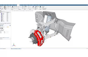
... 使设计人员和分析人员能够专注于仿真结果。 设计和概念建模 扫描到 CAD 制造模型准备 夹具设计 逆向工程 三维打印 运动动力学 用于 3D 打印的 STL 准备 仿真模型准备 钣金 CAE 建模 快速成型制造 Ansys SpaceClaim 3D 建模软件快速解决几何问题 Ansys SpaceClaim ...
ANSYS
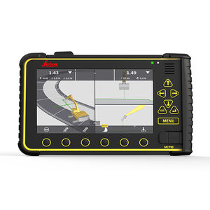
... Leica Geosystems 为所有机器控制解决方案提供了一个革命性的软件平台。Leica MC1 整合了所有机器应用,是指导所有重型建筑机器并使其自动化的全能软件解决方案平台。 Leica MC1 机器控制软件凭借修改模型和表面记录等功能,继续朝着实现智能数字现实的方向发展。MC1 将设计模型与机器切削刃(如铲斗或刀片刃)的实际位置进行比较,帮助操作员定位机器,以实现规划设计,同时以数字方式实时显示进度。MC1 ...
Leica Geosystems/徕卡
... 实验室管理软件。 它的模块化设计适应任何实验室的规模和结构,因此完全适合每天20个工作的小型店面以及每天生产5000个以上工作的大型实验室的需要。 完整的处方药生产数据管理 基于多语言WindowsTM的软件计算和处理标准和数字镜片背面的数据 完全支持复杂的Rx工作,如包边计算、特殊斜面、鞍座等。 RX-Universe与Satisloh和其他制造商的最新镜片生产设备和软件相连接。 一个与你一起成长的实验室管理软件 该系统为实验室提供了极大的灵活性,可以根据自己的需要选择必要的软件包和模块,并随着实际需要的增加而增加 ...

... 独家设计的进一步演变。优化的高科技让你拥有更准确的数据。能够分析用户的每个视觉测量的真实信息,为每个镜片创造一个更准确的数学计算。 优点 为每个用户100%定制镜片。 卓越的视觉舒适度。 提供最佳的佩戴状态。 是运动包装和时尚框架的理想选择。 适应性数字曲线技术,纳入所进行的计算中,通过允许根据每个用户的处方定制视野,使结果最大化。除了RxMe+产品系列提供的可能性外,还可以根据每个客户的具体视觉要求进行设计。 优点 最大限度地减少了斜视差。 快速适应 卓越的视觉舒适度 均匀的功率分布。 对称的数字曲线 专利技术,为镜片佩戴者提供卓越的视觉。这是一种激进的方法,使镜片的设计具有非常平滑的平均功率曲线。 卓越的病人舒适度 在所有方向上都有清晰的视野 最大限度地减少了传统渐进镜的模糊现象 病人适应时间更快,病人满意度更高 优点 为每个用户提供独特设计的镜片 最大限度地减少光学畸变的过程 设计更适合每个客户的视觉状况 它有一个点对点的计算方法,直接转换为100%的数字表面。这项技术允许你从一个标准的半成品毛坯创建任何类型的自由形状的镜片。 优点 100%数字设计 视觉舒适 ...
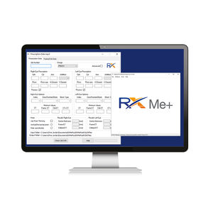
... 一系列不同的设计可满足各种患者的需求和镜架尺寸。 RxMe镜片设计 RxMe设计是入门级的设计,已经提供了先进的优化选项,如可变偏心或边缘混合。 除了一般用途的渐进设计,我们的产品线RxMe提供了已经设计好的或替代传统双焦点镜片的设计(如生活方式设计)。 该软件直观且易于使用,可与Satisloh的机器和Rx-Universe实验室管理系统(LMS)无缝连接,并可与符合Vision Council(VC)标准的LMS集成。 入门级渐进式镜片的设计 RxMe ...
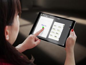
... :个性化和小标牌的简易雕刻软件 CAD和驱动软件 ABC软件是用于刻宝激光和机械设备的最简单雕刻软件。只需3个简单的步骤即可从计算机或平板电脑进行雕刻! • 直观的视觉界面 ABC是一款简易软件,为简单的雕刻需求而设计。整个软件的界面基于视觉图标简单明了。3个步骤快速创建雕刻任务:1.选择板材尺寸。 ...
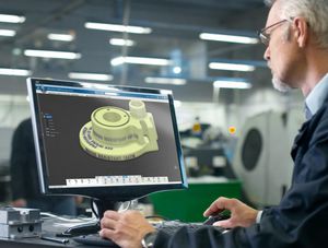
TYPE3-CAA:直接在CATIA®PLM过程中进行设计,矢量化,嵌入文字,logo,符号 CAD/CAM软件 TYPE3-CAA是CATIA®软件中唯一的文字创建和映射插件。 • 创建和更改文本,以及管理矢量字体,数字和符号。 • 用专用参数简单快速地矢量化黑白或彩色图片。 • 在复杂的3D形状上灵活高质量地投影和映射文本,符号,logo或图形。 试用版适合各种V5和3DEXPERIENCE发行界面,文档提供英语,法语,德语,日语,意大利语和中文。 文字创建 直接在 ...

3DESIGN:3D珠宝设计软件 3D珠宝设计软件 尖端的3D珠宝设计软件让您的业务遥遥领先。 专用的珠宝工具 • 使用与您的车间工具类似的模块。藏在珠宝商工作台的虚拟抽屉里。 易于学习,易于掌握 • 3Design像珠宝商一样思考。您无需成为工程师即可使用此软件。像艺术家一样设计! 参数树:优化您的反应时间 • ...
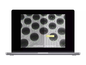
... 二维X射线检测软件 大型和强大的图像处理软件,用于编制自动测试周期。手动以及全自动的X射线检测,可以做到简单易行,不言而喻。 快速而简单的X射线检测从这里开始 Phoenix X|act是一款大型且功能强大的图像处理软件,用于编程自动测试周期。手动以及全自动X射线检测,都可以做到简单易行,不言而喻。对于手动X射线检测,威门科技的行业领先的Flash!™图像优化技术可实现更快、更可靠的故障检测。 探索Waygate ...

... nicelabel 10 - 新一代标签软件,从简单易用的标签设计器到标签管理系统,对整个标签流程进行数字化改造 将文件导入计算机 每天,NiceLabel解决方案都在帮助客户利用条形码和RFID技术简化业务流程。 除标签设计软件外,NiceLabel 还提供各种工具,使您能够轻松创建专门的打印解决方案。 只有专用解决方案才能消除人为错误,提高生产率。 使用NiceLabel,像各行各业成千上万的企业一样,降低标签制作的复杂性和成本。 立即开始并完成标签设计 NiceLabel设计器提供类似微软 ...
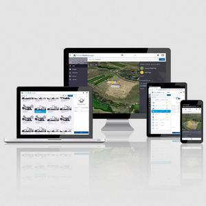
... 从办公室排除现场问题,无论您身在何处,都能高效地为团队提供支持,并在出现问题时迅速做出反应。 通过自动数据传输保持联系 Trimble WorksManager 软件可通过与现场设备之间的自动数据传输,确保您始终保持连接并及时更新。跟踪您的设备位置并远程排除故障,以保持工作正常进行并降低成本。 设计管理和传输 利用 WorksManager 数据管理软件,通过互联网轻松地在设备之间传输数据。 ...
Trimble Navigation - Construction Division

AVEVA™ E3D Design是目前最先进且功能强大的工业三维设计软件之一,通过实现无碰撞的多专业设计,从而最大限度提高工程设计效率。 以数据为中心的多专业 3D 工程与设计 AVEVA E3D 是全球领先的 3D 设计解决方案,适用于工厂、海事和电力行业。它能够实现强大的可视化、无冲突、多专业的 3D 设计,可以快速生成准确的图纸和报告,以降低新项目和已有项目开发的成本、用时和商业风险。 AVEVA E3D ...
AVEVA Group plc
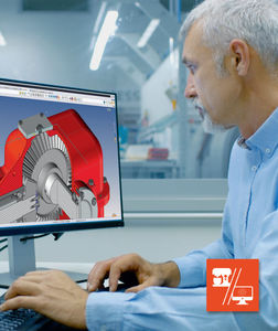
... 而不会被另一个同时修改的零件和装配体所干扰。 该机械CAD解决方案包括一个原生和透明的PDM。所有软件的输入/输出都由管理工具控制,该工具控制着零件、装配体以及更广泛的项目中所有文档之间的链接。你可以对零件和子装配体进行索引的更改和小/大的修改,特别是在 "远程 "和 "协作 "模式下工作。 这是一个简单的CADCAM软件,具有:对话框,强大的撤销和重做功能,即时创建和使用功能元素,并自动存储和文件,便于返工。所以,这套CAD解决方案是一款真正的制造工艺管理软件,建模能力突出。 还有丰富多样的零件库 ...
TOPSOLID SAS/顶层固体

TopSolid'Wood是一款关于木材行业的数字化设计和加工环节的软件。这款木业CAD软件具有实用的功能和无限的三维建模。作为一款三维CAD软件,它能灵活地优化你的工作,为协同工作提供了必要的工具,并能精确、快速地绘制图纸。 它也是一款二维半-三维-四轴和五轴的加工软件,具有不可思议的加工模拟功能。它拥有无限的创造力。TopSolid'Wood是基于Parasolid精确建模器的。这款三维设计软件具有特殊的功能,从建模阶段开始,就可以在三维模型上集成复杂的加工问题。这些专业的功能也可以被精确地定制 ...
TOPSOLID SAS/顶层固体
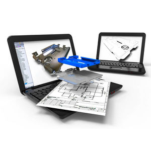
使用TopSolid'Sheetmetal,您可以用一个一体化的解决方案来设计和制造您的零件,从而显著提高生产效率:这是一个独特的集成CADCAM软件,它提供了广泛的手动功能选择,并集中您的数据,使您的项目在工业化过程中节省了大量的时间。 这款三维设计软件同时也是一款制造过程管理软件:有一个自动管理废料和材料跟踪,专家级的机器后处理程序和文件管理(车间数据表,标签管理)。 基于Parasolid精确建模器,TopSolid'Sheetmetal通过强大的功能检索所有外部数据。 - ...
TOPSOLID SAS/顶层固体
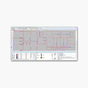
... 自動或手動控制排序、起點和最佳化方向 • 自動切斷功能 • 按圖層刪除公共線、重複實體和邊緣切割 • 靜態工作台上的 V 型標記適用於比工作台長的樣板 • 能夠透過內建腳本語言與 ERP 系統集成 具有 CAD 工具和效能 • 所有基本 CAD 指令 • 匯入大多數 CAD 檔案格式 • 區塊操作功能包括移動、旋轉、縮放、鏡像、擦除、複製等 ...
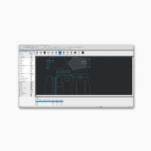
... 將現有的硬拷貝圖案數位化,甚至編輯和最終確定現有的數位圖案 • 在修正形狀、添加或調整細節以及導入圖案時,在每一層完好無損的情況下行走圖案 • 使用可移動工具列建立您自己的工作環境 • 無需訪問選單即可快速存取最常用的功能 • 無硬體鎖定,包括所有主要 CAD 格式的匯入和匯出

... 高效的控制系统工程和配置 Control Builder可以用来配置AC 800M的控制和安全应用。除了符合IEC 61131的编辑器外,还提供了控制模块图编辑器,用于控制应用的面向对象的设计和工程。 IEC 61131-3工程 Control Builder是一个强大的工具,用于为AC 800M控制器创建控制解决方案和可重复使用的控制库。它都是在基于Windows的环境下完成的,为ABB的工业控制器AC 800M提供了广泛的控制功能。它支持符合IEC 61131-3标准的所有五种编程 ...
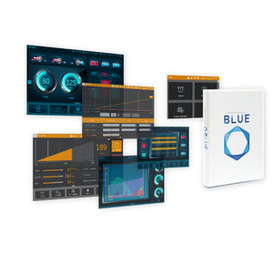
... 多功能软件蓝色 多功能软件 革命新软件,蓝色将提供硬件设计的替代经验。 任何人都可以轻松地创建和更改允许手势操作的动态屏幕。 BLUE 将提供突破性的多功能设计风格。 多功能软件 BLUE 3.1 Service Pack 1 发布了新的基本人机界面 白皮书 “简化和加快人机界面屏幕设计终于现实” B ...
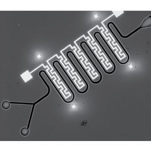
... 与聚焦离子束扫描电子显微镜配合使用的快速原型软件,用于系统规划和构建多层纳米器件。 Thermo Scientific NanoBuilder 软件是系统规划和构建多层纳米器件的工具。它通过将 CAD 文件划分为有序的项目来实现,便于生成以前繁琐甚至无法构建的复杂结构。NanoBuilder 软件支持所有 DualBeam(聚焦离子束扫描电子显微镜,FIB-SEM)制图工艺,可在多个部位对大型复杂纳米结构进行精确制图:FIB ...
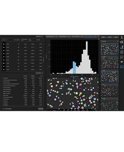
... Scientific Phenom ParticleMetric 软件,您可以使用任何 Phenom 台式扫描电镜为众多亚微米颗粒应用收集形态和粒度数据。ParticleMetric 软件的全自动测量可实现超越光学显微镜的视觉探索,从而在粉末设计、开发和质量控制方面带来新的发现和创新。 Phenom ParticleMetric 软件可快速、轻松地提供有关颗粒的深入数据;这些深入数据可帮助您提高产品质量,加快研究进度。 ParticleMetric ...

... Roland R-Wear Studio 软件配备了设计精美定制服装和礼品的所有必要工具。从 T 恤衫和手提包到酒瓶和手机,该软件都能进行个性化设计,从而轻松提高利润。可能性是无限的。 功能简介 -使用 Roland EGX 雕刻机创建热固水钻模板 -使用罗兰 GS-24 切割机制作彩色热贴字母、徽标和图案 -使用设计和照片制作各种可盈利的定制图形 -导入 bmp、jpg、gif、png、ai ...
ROLAND/罗兰
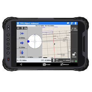
... 探索X-PAD Ultimate Build,为您的施工任务提供用户友好的现场软件。在与用户和合作伙伴的合作下,我们的综合解决方案是为满足您的测量和布局需求而量身定做的。凭借其低维护成本和选择任何现场控制器的灵活性,该解决方案使您能够自信地完成您的任务并优化您的工作流程。想了解更多吗?请与我们联系。 兼容的设备 X-PAD Ultimate Build确保了现场的生产力,并提供了完美的整合,甚至是来自不同测量仪器的数据。该解决方案与以下设备兼容。 TPS ...

... 未知圆弧端齿;人字齿轮;变速齿条;链轮;GD&T不均匀公差带评价;GD&T局部平面度评价;点云CAD自动迭代;Q-DAS半年免费DEMO License。 QUINDOS CAD Basis 零件编程基于CAD数据文件。以IGES、STEP和BREP格式输入和输出标准几何特征的3D数据。立体可视化,加以缩放、移动镜头和旋转,并在几何特征上面产生探测点。 QUINDOS ...

... 你要记住,文件本身只有几个字节。它不是有价值的最终资产,只是生产、评估或复制它所需的数据。 这可以多快、多容易、多好地完成取决于工程师和逆向工程包。当Hexagon开发新的逆向工程软件REcreate时,重点是提供一个无缝的工作环境,使其易于从最初的3D扫描到创建可制造的CAD模型。 REcreate逆向工程软件还必须能够被设计、生产和检验团队中尽可能多的用户访问。此外,它必须足够强大,能够处理任何逆向工程应用,无论是重构遗留部分;确保新组件的精确匹配;为不存在的零件创建计算机辅助设计,或更新设计文件以反映制造或原型制作过程中发生的更改 ...

... Geomagic Design X是专门为将三维扫描数据转换为高质量的基于特征的CAD模型而设计的。它结合了自动和指导性的实体模型提取、令人难以置信的精确表面拟合有机三维扫描、网格编辑和点云处理,能做到其他软件无法做到的。现在,你几乎可以扫描任何东西并创建可用于生产的设计。 ...
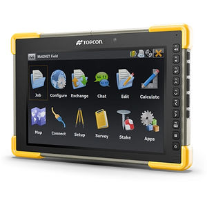
... 强大的布局、测量和施工工作流程尽在掌中 易于使用和学习 三维布局 数据处理 基于现场的专业优质报告 基于地图的工作流程 混合 GNSS 和全站仪控制 利用 MAGNET Field 的强大功能 MAGNET Field 通过提供精确测量、数据采集和实时协作,简化了测量和施工工作流程。 它可与其他拓普康产品无缝集成,兼容 50 多种行业标准格式,是各行业专业人员的重要工具。例如,测量人员和建筑专业人员使用 MAGNET Field 对土地、建筑物和其他结构进行精确测量并绘制地图。 测量、测绘和标记点 MAGNET ...
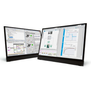
通过图形化编程进行测试和测 LabVIEW集成了快速搭建自动化测试系统所需的一切。 内置数千个可用分析函数 使用可配置的交互式显示元素 提供用于自动化每个仪器和数据采集硬件的驱动程序 可与其他语言和行业标准协议实现连接 了解LabVIEW 2023 Q1 从虚拟环境中调用Python。简化LabVIEW项目共享。安装更新速度加快。 LabVIEW 2023旨在节省您的时间。 LabVIEW的应用领域 在过去35年里,LabVIEW一直是工程师开发自动化测试系统的首选工具。不管是简单的电压测量,还是尖端的太空任务,我们一起了解一下LabVIEW如何为您的后续项目画龙点睛:
NATIONAL INSTRUMENTS/美国国家仪器
... 制造 ESTmep™、CADmep™ 和 CAMduct™ 软件为 MEP 专业承包商提供了一套集成工具。通过与 BIM 和 CAD 设计工作流程和交付成果的紧密集成,以 LOD 400 为机械建筑系统进行估算、细化和驱动制造。 使用特定于制造商的内容生成更好的估算 创建更精确的详细安装模型 制作用于制造的金属板 ESTmep估算 通过成本分析和报告深入了解项目成本,并生成具有竞争力的投标书 CADmep ...
AUTODESK/欧特克
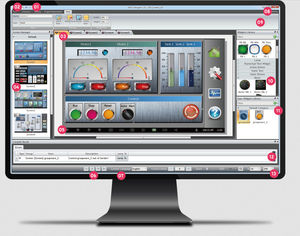
... iFace Designer®是一个跨平台的可视化软件,从中编译的程序可以安装并在HMI和工业面板PC上运行。ribbun UI中的标签使开发项目变得简单明了。只需点击几下,你就可以很容易地找到功能和属性。其 "面向对象 "的设计使HMI与PLC(可编程逻辑控制器)、变频器、网关、控制器、传感器等通过使用 "标签系统 "轻松连接。 iFace-Designer的主要功能元素 绚丽的矢量图形小部件库 按钮、开关、灯、仪表、条、滑块、图表...等。 覆盖面广的PLC驱动数据库 支持标准协议和 ...
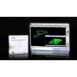
... CAD 功能(无体积建模器) 适用于 Windows 7、8、10 和 11,32/64 位版本 导入DXF / EPS / AI / 3D STL 数据 使用第四轴在圆柱体表面雕刻 技术 CAD 功能(无体积建模器) 可在 Windows 7、8 和 10(32/64 位版本)下执行 导入:DXF / EPS / AI / 3D-STL 数据 导出NCP 格式 成熟的钻孔/轮廓/袋铣 CAM ...
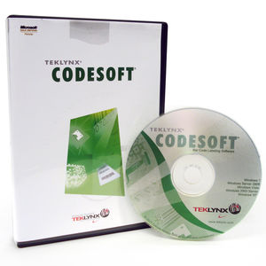
... CodeSoft软件 这款企业级的标签设计软件允许用户设计和打印用于产品识别和跟踪的定制标签。CodeSoft 软件是最复杂的条码标签项目的专业解决方案。CodeSoft擅长于与用户系统和第三方软件的整合。该软件为任何项目提供了一系列的条码标签设计功能,从简单的标签设计到一般的条码设计。CodeSoft让您轻松灵活地设计和打印标签。无论您需要打印文本、条形码或图形图像,固定或可变数据,用户定义或数据库驱动,布雷迪都有条码和标签软件来处理您所有的定制标签需求。 ...
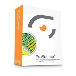
... 因此可以随时详细查看测量结果。 可以对光源和照明系统的关于角度分布的亮度和色度进行详细分析。 ProSource 允许其他照明设计软件访问相同的光源数据和光线集,且仍可获得无与伦比的测量准确性。ProSource 还可与ASAP®、LightTools®、Photopia™、IES TM-25、FRED®、TracePro® 、OpticStudio™ (ZEMAX)及其他软件配合使用。
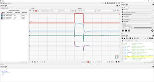
... Galil 设计工具包(GDK)是 Galil 运动控制公司最新推出的软件包,适用于 Galil 运动控制器和 PLC。GDK 建立在高效、强大的 gclib 编程 API 基础上,使与运动控制器和 PLC 的通信变得简单、高效。GDK 的模块化设计允许与一个或多个控制器进行通信,其核心工具集包括终端、程序编辑器、查看器、设置工具、示波器和调谐器。 GDK 采用客户端-服务器架构,允许 GDK 与许多控制器通信,同时主机程序也与这些控制器通信。有了 ...
为提升搜索质量,您认为我们应改善:


请说明:
您的建议是我们进步的动力:
剩余字数